Birthday Challenge Running
 |
Because the running will be the
part that will tax me the most I will be breaking it into three 7 mile runs. The three together will total the required 34 kilometers. All three of these runs tend to be slightly to mostly downhill. This will greater increase my chance of completing the runs, by allowing me to use a little less muscle exertion for each step. It will, also, hurt my knees more, which won’t be fun.
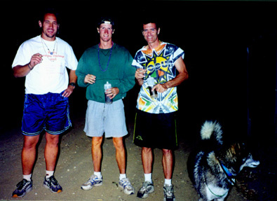
Bubba, Enzo, Stainless, and Tuco at the start of the midnight run. |
Run #1
This run was chosen to be the first because it is the flattest and the hardest.
This run starts in San Timoteo Canyon a few tenths of a mile past (away from Redlands) where Redlands Boulevard cuts off to the South to connect with the 60. The start is marked by a sign on the South side of the road that tells about the underground cables there. I also built a small cairn using a few bottles and rocks. I doubt they will be cleaned up before the run.
Head down (towards Redlands) for 5 miles. Turn right up Fern for .3 miles. This is steeper than I thought and I will probably walk it, or run it until I am forced to walk. At the top of the climb, turn left down Terracina for .8 miles. Turn right on Brookside for .3 miles. This stretch is sort of rolling and made me realize that I wasn’t running downhill. Turn left on Bellevue for .2 miles. Turn right on Barton for a very brief .1 mile. Turn left onto Kansas for .3 miles. This run stops on the south side of the driveway into my apartment complex.
Run #2
This run has lots of sort of steep downhills on it, combined with a couple of rolling sections. Start at the driveway at #30980 Sunset Ave. and head to the West along Sunset. After 3.3 miles Sunset ends and Serpentine begins when the road crosses Allesandro. Continue straight ahead on Serpentine. This is where the rolling section begins. Continue on Serpentine for 1.2 miles. Turn left onto Smiley Heights for .8 miles until it ends at Cypress. Turn right onto Cypress for .5 miles. Make a left onto Lakeside and follow it for .8 miles until it hits Barton. Turn left onto Barton for .1 mile and turn right down Kansas for .3 miles. This run stops on the south side of the driveway to my apartment complex.
Run #3
This run starts at essentially the same spot as Run #2, except you start slightly further to the West and run towards the East. This is the easiest of the three runs, with only a couple of short uphills and a flat mile on Highland. It might also be the worst on my knees, especially since I will be doing it third. Start at #30707 Sunset Ave (I may move this further to the West so this run can finish at the same place on my driveway. We came up with two different measurements the two times we measured the distance.) and head East for .5 miles. Turn left onto Palo Alto and follow it downhill for .5 miles. Make a right turn onto Wabash and climb a steep short hill before going downhill for a total of .3 miles. Turn left onto Mariposa and climb another short hill before beginning the long descent to Highland. You will follow the same street for the next 2.6 miles, but its name will be changed from Mariposa to Garden to Cajon. We just love to do that in Redlands, it would appear. Turn left onto Highland and run for a mile. Turn right down San Mateo and follow it for 1.3 miles. Just before they decide to change it’s name, turn left onto Brookside. Run down Brookside for .5 miles and try not to notice that before you run the half-mile the name will be changed to Barton. Turn right onto Kansas and go past the driveway to my apartment to the corner of Orange. Turn right onto Orange and go until you get to the streetlight with the speed limit sign on it, on the right. Breathe a huge sigh of relief because the run is now over. Let’s see what that fatigue does to my performance in the other events.